Search...
Overview

Our client — an Austrian start-up specializing in digital infrastructure inspection and lifecycle management — reached out to us with the expressway project.

This project involved the creation of a 3D Revit model of the Vienna Northern Edge Expressway S2 — a direct extension of the Vienna Southeast Tangent A23 motorway that runs through the 22nd district of Vienna, Donaustadt. With a length of just 7.4 kilometers, it is by far the shortest expressway in Austria — however, its intricate topographic details around and structural features make it stand out, requiring detailed 3D modeling.

Scope of work: The highly detailed model of the overbridge, topography, and surroundings.

Input: Full Point Cloud of the overbridge and topography.

Output: Revit 3D model of the overbridge.

Services: BIM
Subservices: Scan to BIM
Industry: Infrastructure
Object type: Bridges
Area: 29600 m² / 318620 ft²
Tools used: Autodesk Revit, Autodesk ReCap
Share:
Project stages
1. Receiving input
2. Analyzing input, requesting additional information, selecting optimal team structure
3. Preparing the Point Cloud for work
4. Modeling the bridge surface and its supports
5. Modeling topography and surrounding area
6. Quality control and working on improvements
7. Project support
1

Project highlights

This project was unique due to the presence of a large road with an overbridge and complex topography. The overbridge featured numerous elements, including railings and technical structures, which added to the complexity of the task. Data collection was carried out using drone photography, followed by photogrammetry to process the captured materials.

We were also tasked with modeling each road sign to create a highly realistic representation of the road and its surroundings. This was aimed at addressing the organization of traffic at these heavily congested crossroads, as the S2 has become the main route connecting Marchfeld to Vienna, with heavy traffic causing constant jams and long waiting times at the intersections. Thus, the 3D model incorporating road signs would help coordinate traffic optimization initiatives.

Point cloud vs Model
Challenges and solutions

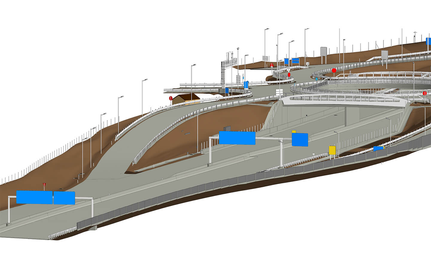
The project involved several challenges, one of which lay in modeling large, branched elements that form a complex system. To manage this, the road and bridge were divided into sections. When one part of the road surface overlapped another, the sections were split into different elements. This ensured the correct functioning of Revit tools and enabled the software to process each section independently, thus preventing conflicts between overlapping geometry.

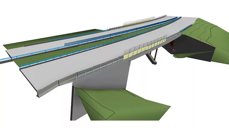
Another challenge was the variations and inconsistencies in point cloud data due to factors such as data resolution and scanning angles. To solve this and align the model’s road surface with the real elevation marks represented in the point cloud, each part was modeled using the “Floor” category, with a regular system of internal edges.

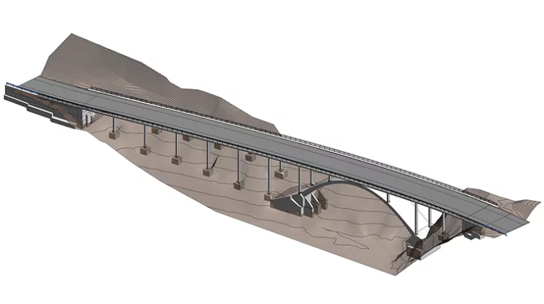
To maintain the accuracy of the earth’s mass while working with the road surface’s complex geometry, the overlap had to be managed carefully — particularly when dealing with irregular road shapes or changes in elevation. Therefore, topography was modeled using the “Mass” category by outlining earth profiles with regular steps and then creating surfaces based on these profiles. To ensure the earth’s mass elements matched perfectly with the edges of the road surface, the earth model was initially created with some overlap. The edges were then trimmed with a void, precisely matching the road surface edge shape.

Additionally, at the client’s request, all bridge railings were modeled with a high level of detail, with posts and rails matching the point cloud as closely as possible. Additionally, all road signs were modeled to accurately reflect the real surroundings.

Point cloud vs Model

Traffic and road signs

The S2 has become the main route connecting Marchfeld to Vienna. With the massive increase in traffic, frequent congestion and long wait times developed at its intersections with Breitenleer Straße and Rautenweg—even during off-peak hours. As the S2 is extended toward the planned northern motorway, further increasing traffic volume, the removal of these intersections has become inevitable.

To help organize traffic at these heavily congested crossroads, we were tasked with modeling every road sign to create a highly realistic representation of the road and its surroundings.

1
Point cloud vs Model
Benefits
Flexibility in working with different types of construction (roads, bridges, etc.)
A highly detailed model of the topography and surroundings
Precise as-built model based on the point cloud
Used Tools
1
Autodesk Revit
1
Autodesk ReCap
view project view more view photos